Palmoil.io
Manage business risks in your palm oil supply chain. Palmoil.io has the most comprehensive and regularly updated risk database available.
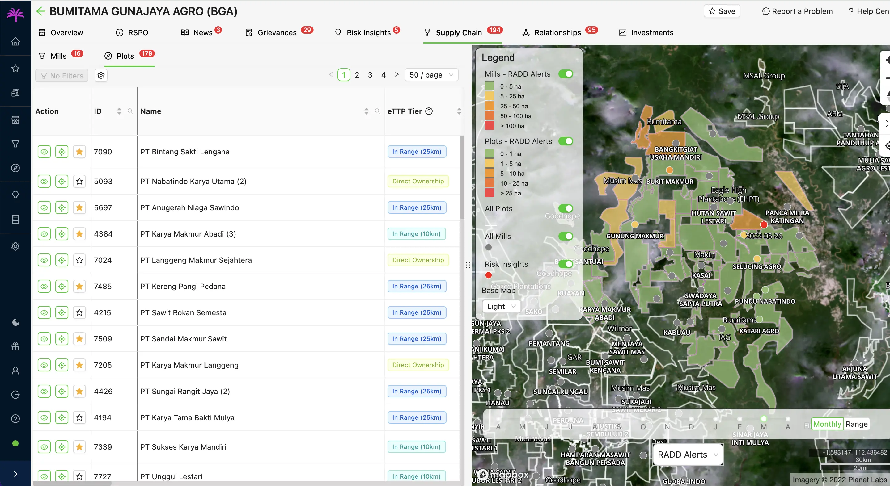
Founded in 2017, MapHubs is a technology company that provides software and services to organizations monitoring natural resources. Leading companies and organizations trust MapHubs.

In Action
Read about how MapHubs has helped government agencies, agriculture companies, and watchdogs map and monitor deforestation and other natural resources issues.